History of the Wales Coast Path
Seaside rambling has long been a popular pastime in Wales. Before the coast path project, the country was home to a number of dedicated long-distance, coastline-hugging trails, including the Pembrokeshire Coast National Trail (opened back in 1970) and Isle of Anglesey Coastal Path (completed in 2006).
But, in the late-2000s, a plan was hatched to web these existing trails together to form one unbroken walkway along the entire coast of Wales – the first footpath in the world to stretch the full length of a country’s coastline.
In May 2012, the Wales Coast Path (WCP) opened to the public. Spanning 870 miles (1400km), the trail begins at the north-eastern English border, near the town of Flint (on the outskirts of the English city of Chester), and traces the beautiful shoreline of Wales right round the country, finishing at the Welsh town of Chepstow, situated on the south-eastern English border.
While this seismic trek would be more than enough for mere mortals, the very hardiest of hikers can combine the Wales Coast Path with the Offa’s Dyke Path (177 mile/285km), running along the border with England, to create an epic 1047-mile (1685km) ring around the entire circumference of Wales.
The Wales Coast Path route
The Wales Coast Path is divided into eight sections, which range in distance from 68 to 182 miles (109 to 293km). Rather than tackle the entire distance in one go, which can take between seven and 12 weeks to finish, walkers usually opt to undertake one section at a time, with each taking around one week to complete (though some longer segments can take up to two weeks or more, depending on pace).
Section 1: North Wales Coast and Dee Estuary
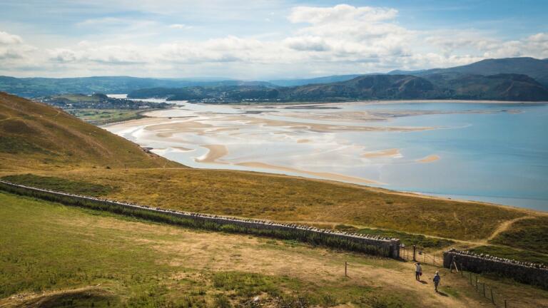
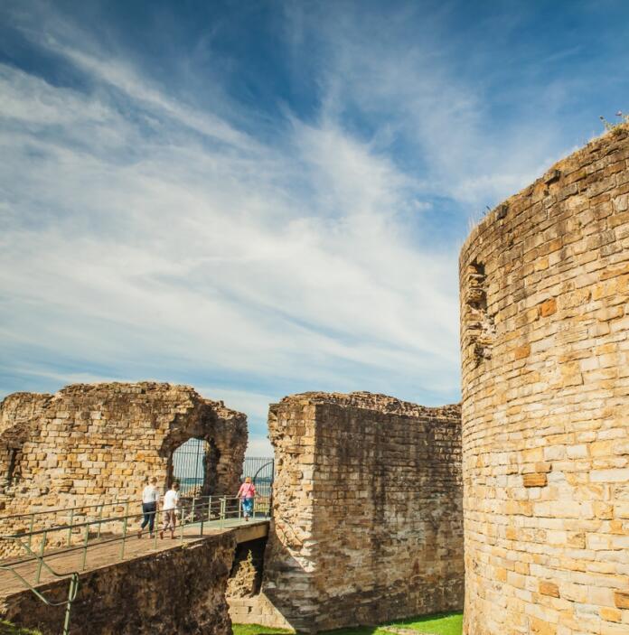
When walking the trail anticlockwise (from north to south) the first section of the path meanders along the north coast of Wales for 81 miles (132km). Starting at the English border, the trail passes the towns of Flint, home to the ruins of one of the first castles built by Edward I during his 13th-century invasion of Wales, and Llandudno, a Victorian seaside resort with a 19th-century pier and a – slightly tenuous – Alice in Wonderland connection, before arriving at Bangor, considered to be the oldest city in Wales. Today it boasts cosy pubs, a cathedral dating back to the 6th century, and the Storiel Museum and Art Gallery, focused on the history of the region.
Section 2: Ynys Môn (Isle of Anglesey)
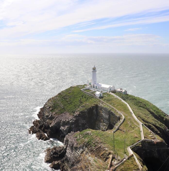
This section of the trail forms a 135 mile-ring (217km) around Ynys Môn (the island of Anglesey). Beginning at the Menai Bridge, designed by celebrated civil engineer Thomas Telford (of UNESCO-listed Pontcysyllte Aqueduct fame), the trail heads east, passing the 13th-century Beaumaris Castle, and then north, taking in view of the oft-photographed South Stack Lighthouse, which stands proudly at the north-western corner of Wales. From here, the path squirms back down south, skirting a number of golden-sand beaches that are perfect for a dip on a summer day, before looping back to the Menai Strait.
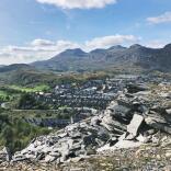
Section 3: Llŷn Peninsula and Eryri (Snowdonia) Coast
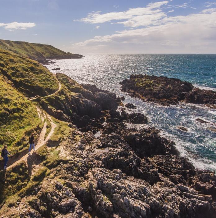
At 167 miles (264km), the third section of the Wales Coast Path is one of the longest. It’s also arguably most beautiful, spoiling ramblers with the unblemished landscapes of both Eryri (Snowdonia) and the wild and beautiful Llŷn Peninsula, which extends westwards into the Irish Sea.
Starting just outside Bangor, the path follows an ancient pilgrimage route along the northern coast of the Llŷn to a now-derelict monastery on Ynys Enlli (Bardsey Island) at the westernmost tip of the peninsula. The route then curves around, passing tiny coastal hamlets like Aberdaron, and fashionable seaside resorts like Abersoch, before reaching the former slate port of Porthmadog and heading south down the Eryri (Snowdonia) Coast to Machynlleth, home to the Museum of Modern Art Wales and a quirky annual comedy festival.
Section 4: Ceredigion
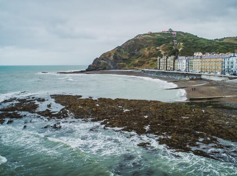
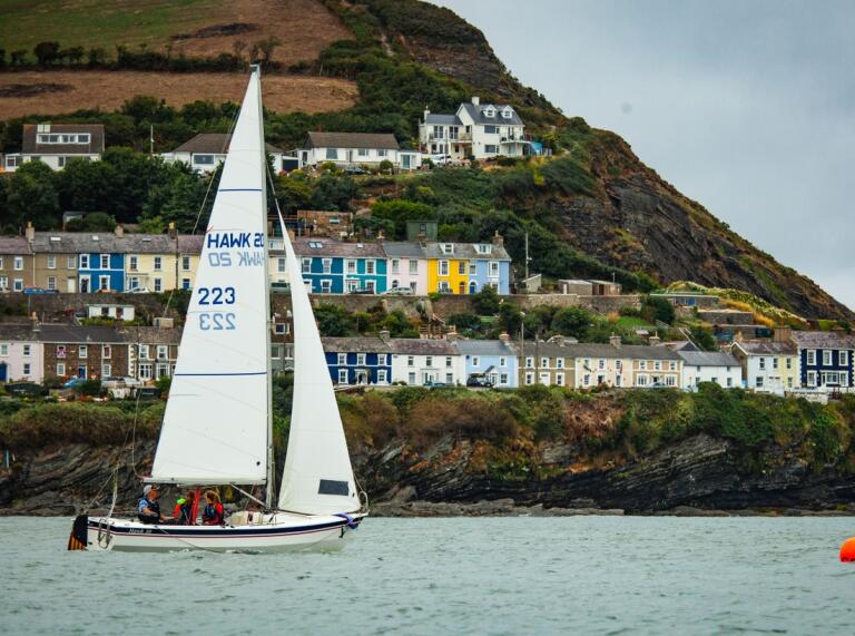
Section four of the WCP is a straightforward swoop along the coast from Machynlleth to Cardigan, covering a total distance of 75 miles (119km). Though a relatively short segment of the route, a number of charming towns beckon walkers to linger a little, including Aberystwyth, one of Wales’ great university towns, Aberaeron, with its restaurant-lined harbour and dolphin-spotting boat trips, and New Quay, a postcard-pretty fishing community that was the one-time home of Welsh poet Dylan Thomas (it’s said the town played a major role in inspiring one of the poet’s best-known works, Under Milk Wood).
Section 5: Pembrokeshire Coast Path
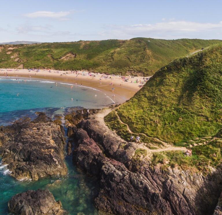
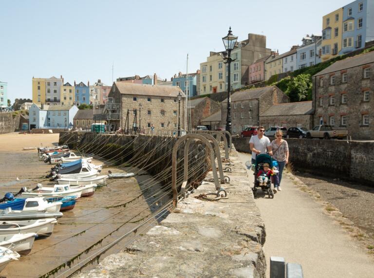
The Pembrokeshire Coast Path is the longest (182 mile/291 km) and perhaps the most popular section of the Wales Coast Path, having attracted ramblers with a soft spot for a sea breeze since it was given ‘National Trail’ status in 1970. The path curls around the rugged Pembrokeshire headland, with sights en route including Abereiddi’s Blue Lagoon, a former quarry pit now turned into an exposed sea pool, the mesmerising St Davids Cathedral, the burial site of the patron saint of Wales, and Tenby, whose pastel-hued, pub-dotted seafront has become a perennially popular stop-off for a generation of ramblers. A little way around the headland is Amroth, which marks the end of this segment of trail.

Section 6: Carmarthenshire
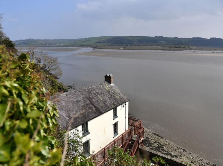
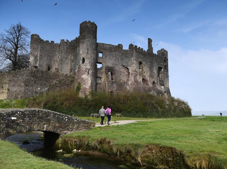
The Carmarthenshire section is the shortest of the eight parts of the Wales Coast Path, covering 68 miles (108 km) in total. Curving around Carmarthen Bay, it passes notable spots including Pendine Sands, where the land speed driving record was broken five times in the 1920s, the castle-topped town of Laugharne, another Dylan Thomas haunt, where the Romantic poet is buried and where his preserved writing shed still stands overlooking the river, and, at the section’s southern tip, the WWT Llanelli Wetland Centre, a 50-acre haven for birdlife, including kingfishers, little egrets and woodpeckers.
Section 7: Gower and Swansea Bay
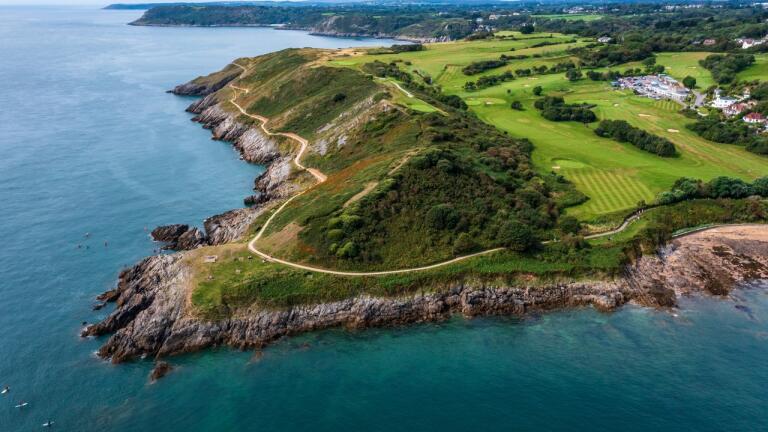
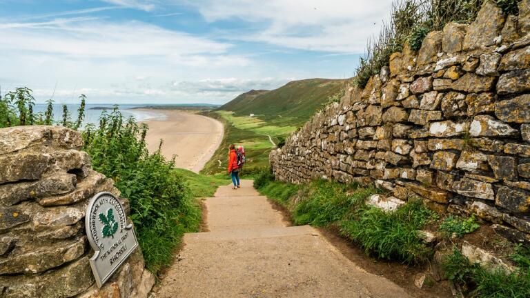
Starting a few miles south of Llanelli, the 69 mile (111km) Gower & Swansea Bay component of the WCP serves as a tour of some of the most beloved beaches in Wales. Essential stops for sand fanatics include Rhossili, a regular fixture on Britain’s 'best beach' polls, the sweeping Three Cliffs Bay, backed by sand dunes and limestone cliffs, and the cove of Langland, with its line of pretty beach huts and sand-side brasserie. The cafés, pubs and historic pier of Mumbles adds urban charm, as does the Swansea seafront, which walkers pass before following the coast path south towards the industrial town of Port Talbot.
Section 8: South Wales Coast and Severn Estuary
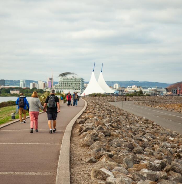
The final section of the route is maybe the most varied, with the 97 mile-trail (157km) beginning at Porthcawl’s popular surf beaches of Rest Bay and Coney Beach, before winding its way through Barry Island, around Penarth’s seafront – skimming the town’s Victorian-era pier – and across the barrage walkway into the bustling streets of the Welsh capital, Cardiff. From here, it’s a straight run towards the English border, crossing the River Usk at Newport, passing the Prince of Wales Bridge, and finishing the overland odyssey just east of Chepstow.
Walking the Wales Coast Path
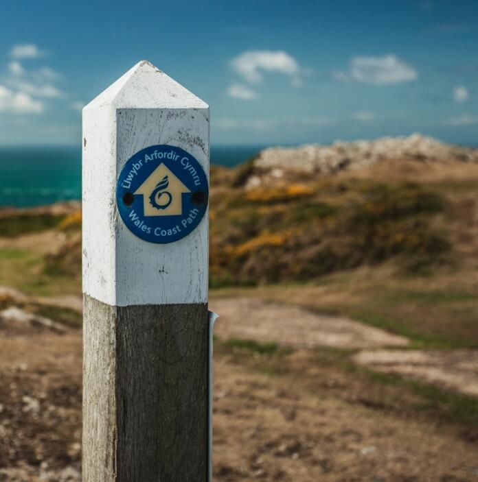
The Wales Coast Path is waymarked along its full length, with hikers guided by signs depicting a white shell with a dragon’s tail on a yellow or blue background, with the words Wales Coast Path written around it.
A series of official guidebooks are also available to aid walkers on the trail, with suggest itineraries and detailed route descriptions. A free Wales Coast Path App also provides information to walkers, with augmented reality displays and audio clips delving into the history of notable sites and landmarks along the trail.
Accommodation, in the form of both campsites and hotels, is available along the route, as are luggage transfer services. Another useful resource is the free Refill app, which notifies walkers of venues on the trail that are happy to refill their water container for free, cutting down reliance on plastic bottles, which harm the environment.